 Yosemite National Park embraces a spectacular tract of mountain-and-valley scenery in the Sierra Nevada, which was set aside as a national park in 1890. The park harbors a grand collection of waterfalls, meadows, and forests that include groves of giant sequoias, the world's largest living things.
Highlights of the park include Yosemite Valley, and its high cliffs and waterfalls; Wawona's history center and historic hotel; the Mariposa Grove, which contains hundreds of ancient giant sequoias; Glacier Point's (summer-fall) spectacular view of Yosemite Valley and the high country; Tuolumne Meadows (summer-fall), a large subalpine meadow surrounded by mountain peaks; and Hetch Hetchy, a reservoir in a valley considered a twin of Yosemite Valley.
.
Yosemite National Park embraces a spectacular tract of mountain-and-valley scenery in the Sierra Nevada, which was set aside as a national park in 1890. The park harbors a grand collection of waterfalls, meadows, and forests that include groves of giant sequoias, the world's largest living things.
Highlights of the park include Yosemite Valley, and its high cliffs and waterfalls; Wawona's history center and historic hotel; the Mariposa Grove, which contains hundreds of ancient giant sequoias; Glacier Point's (summer-fall) spectacular view of Yosemite Valley and the high country; Tuolumne Meadows (summer-fall), a large subalpine meadow surrounded by mountain peaks; and Hetch Hetchy, a reservoir in a valley considered a twin of Yosemite Valley.
.
Click on thumbnails for larger view:
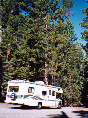 Rather than driving from Texas, we decided to fly to Fresno, rent a Cruise America RV, thereby having more time to explore - less driving. The trip started very badly. We waited 3 hours for the RV to show up at the rental office. When it did, it hadn't been properly cleaned and we had to take it to a nearby dump station to empty the holding tanks contents. Then, the RV developed an awful thumping noise before we left Fresno. It was after 5, on a Friday, and the CruiseAmerica office was closed. Rather than spend the night, and return to the office Saturday morning, we set out to find someone to diagnose and fix the thump. After several stops, mechanics told us conflicting stories and that they couldn't fix it. Fortunately, we ran across Mike at Curry Brothers Diesel Repair. After helping him wash his car, he had us bring the RV into one of his bays and put it on a lift. He diagnosed the problem as a piece of loose metal that was flapping against the driveshaft. He drilled a couple of holes, inserted self-tapping screws, charged us $60, talked a lot, and sent us happily on our way. Now its 8 or 9 o'clock and we decide to go to Wal-Mart and get groceries and other supplies. Eventually, we rolled into Yosemite at 1 AM.
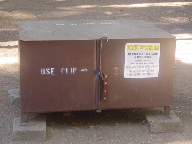 Just before we reached our campsite in Upper Pines campground, a ranger told us that black bears were in the trees 50' from our site! A mother and 2 cubs. Just what you want to hear at 1 in the morning. We found our site, backed in, and bedded down for the night - without incident. The next morning, the bears caused quite a stir. Campers came from all around to view them. They (the bears) came down around noon and left the area without causing any problems. Campers are required to store food in the "bear boxes".
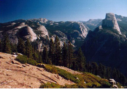
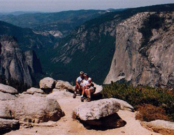
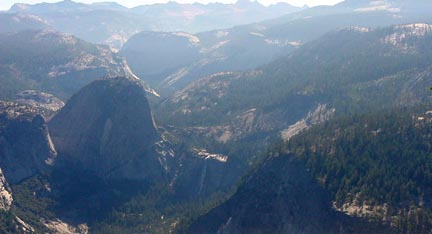
 This is a shot of Half Dome from Glacier Point, an overlook with a commanding view of Yosemite Valley. Glacier Point is located 30 miles (one hour) from Yosemite Valley.
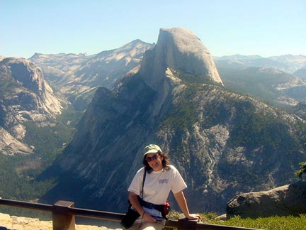 From this overlook, one can see all (most) of the sights in the Valley. Yosemite Falls, the hotels, Merced River, everything. At an elevation of 7,200 feet, Glacier Point serves as the trailhead for many popular day hikes, including the Panorama and Pohono trails, as well as short hikes to Taft Point and Sentinel Dome.
 For backpackers, the Glacier Point Road offers access to trails in the Clark Range and the southern portion of the park. The 16 mile road begins at the Chinquapin junction of Highway 41. This road generally stays open from mid-May to late October. Permits for trails leaving the Glacier Point Road may be obtained from the Wawona or Yosemite Valley Permit Stations. The Bridalveil Creek campground located on the Glacier Point Road is available on a first come, first served basis, June through September.
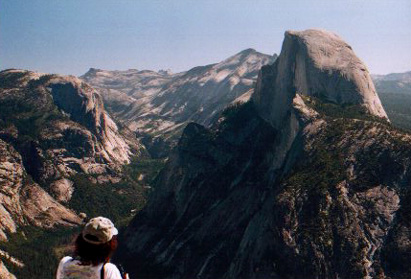
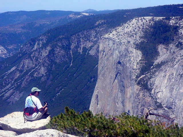 Deb - resting and taking in the expansive views. El Capitan on right.
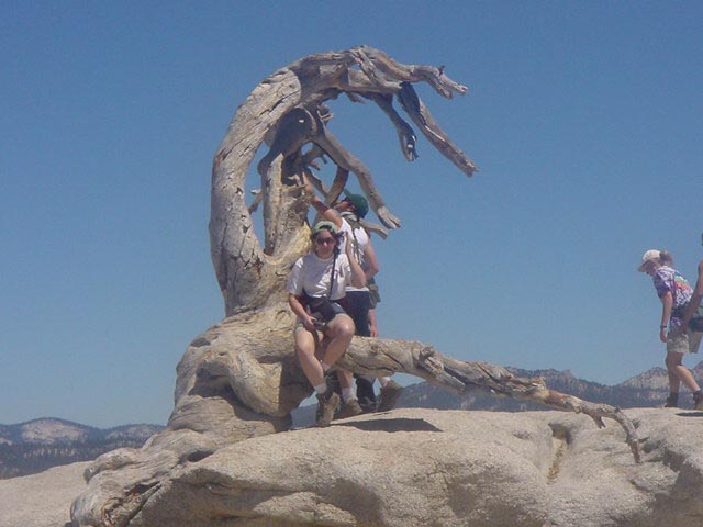 The Jeffrey Pine atop Sentinel Dome. The pine was vandalized in 1984 and slowly died. Beneath the tree us the USGS' marker. Sentinel Dome, at 8122', is the 2nd highest point in Yosemite Valley (behind Half Dome).
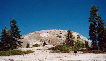 Sentinel Dome is very similar to Enchanted Rock (Texas). It's just much higher, harder to climb, and the views are incomparable.
 We didn't have much trouble with the climb and spent as least an hour taking pictures, relaxing, and munching on protein bars. The trail starts from the same trailhead as the Fissures at Taft Point, the Taft Point / Sentinel Dome trailhead.
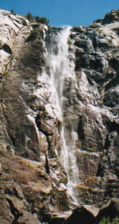 Bridalveil Falls. It gets its name (and also its Indian name of Pohono, "puffing wind") from the way the afternoon up-canyon breezes blow it back and forth. Sometimes the wind is strong enough to send spray back up over the lip of the fall -- in late summer it may briefly stop the falls altogether. Bridalveil is easily viewed by walking a few hundred yards from the parking lot, through a beautiful grove of bigleaf maples. This is one of the best places in the valley for Pacific dogwood. There are also some giant Douglas firs, flourishing in this moist shady corner of the valley.
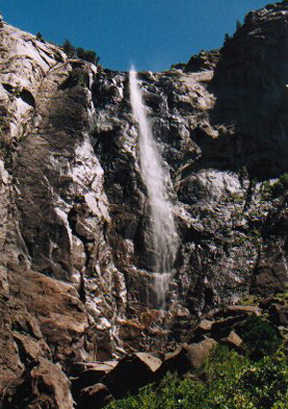 Though Bridalveil Creek seldom dries up completely, it shrinks to a gauzy wisp by late summer. At this time of year it is possible to clamber over jumbled boulders from the official viewpoint to the broad green pool at the base of the falls. When the flow of water is very small, it is an incomparable experience to swim under the falls itself - but beware, the water falls free for over 600 feet and can easily drive one under.
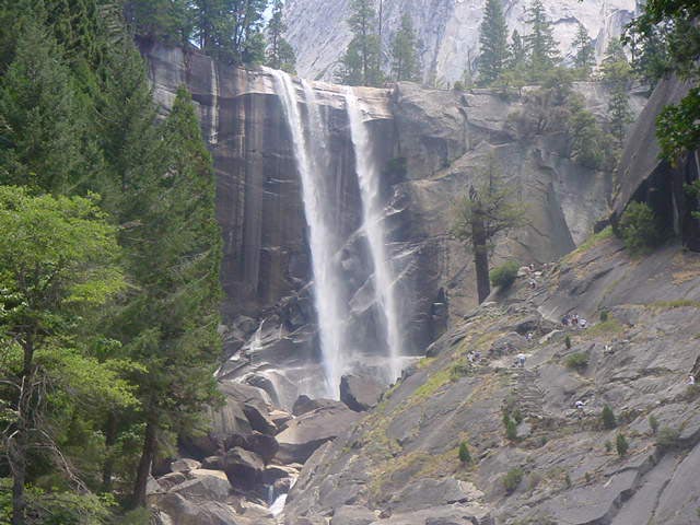
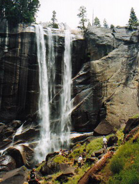 Vernal Falls. Named vernal, for springtime, because the canyon below the falls is kept lush and green all year by spray, this falls is broad and square, in contrast to the horsetail plumes of most of the other falls in Yosemite. Because, like Nevada just above, it is on the main stem of the Merced River, Vernal never dries up, though the roaring torrent of spring diminishes to a filmy curtain by late summer (what we saw).
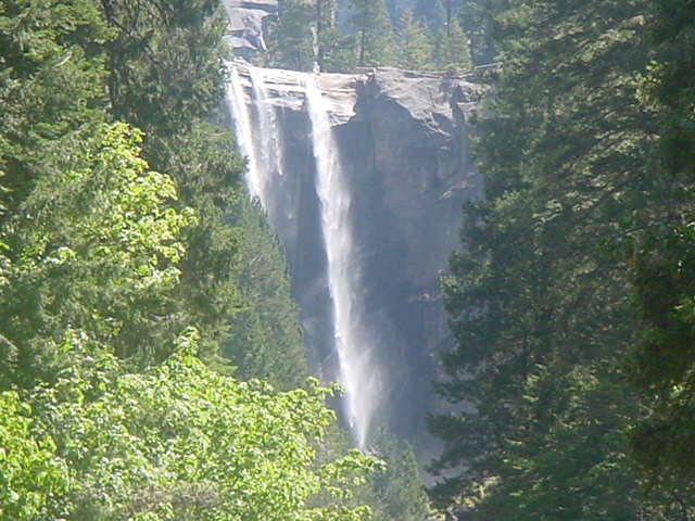 The busiest trail in Yosemite (perhaps in California) leads steeply up from Happy Isles, clinging to the precipitous canyon wall. The trail leads to a bridge over the river with a charming view of Vernal Falls, framed in dark green conifers and bright maples.
 Every spring thousands of people enjoy a close encounter with this beautiful waterfall. The well-named Mist Trail ascends the canyon below and alongside the falls, climbing steeply on hundreds of huge stone steps. Icy spray from the falls lashes across the upper part of the trail, drenching hikers.
 Vernal Falls forms the bottom step of the Giant Staircase that begins with Nevada Falls and is so striking when viewed from Washburn Point (next to Glacier Point).

View My Guestbook
Sign My Guestbook
If you have any questions or comments, email me: backpackingtexan at yahoo dot kom
Return to West Coast trip, 2001.